Home > Apps > Microsoft Windows
File extension list filtered by software name
Terrain Navigator
Found 15 file extension associations related to Terrain Navigator
Platform, operating system: ![]() Microsoft Windows
Microsoft Windows
Go to: Terrain Navigator description
Developer: MyTopo
Terrain Navigator
Developer / company: MyTopo
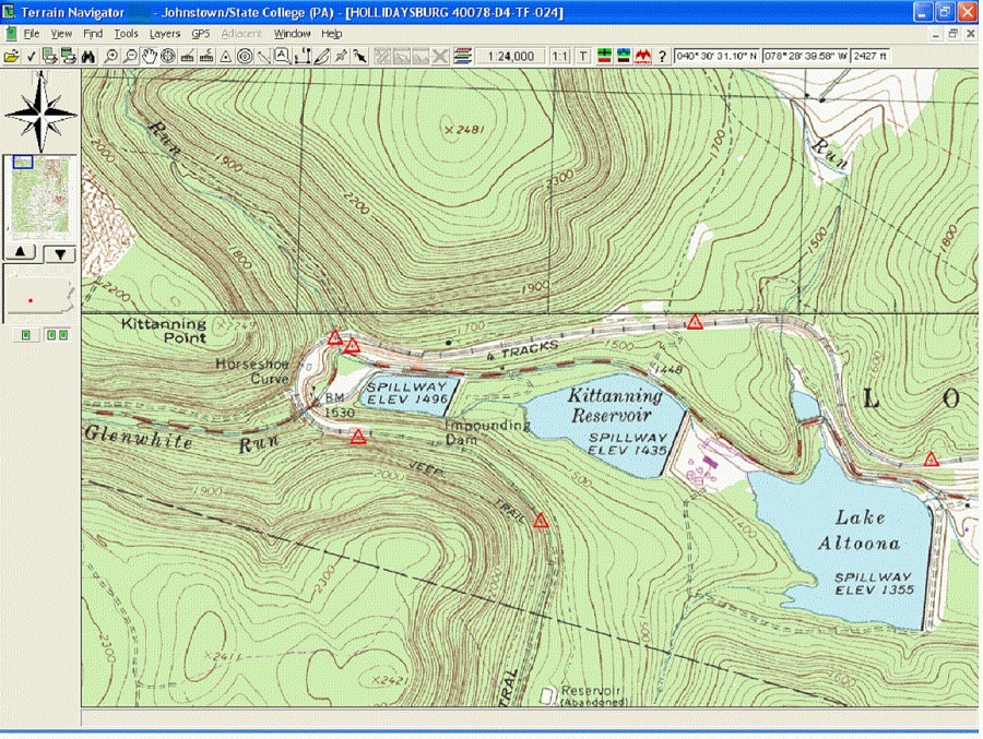
Terrain Navigator Pro (TNP) is powerful and easy to use desktop and mobile mapping software that contains high resolution scans of USGS topographic maps as well as current aerial photographs overlaid with a current street layer. These maps and photos can be customized with labels, marks, symbols, lines, routes, tracks, area fills, GIS data sets, and notes. Once you have finished designing your custom maps, use the built-in printing and publishing to create digital and paper prints with text, logos, inset maps, legends, etc. Layers, maps, and photos can be exported to be used in other GIS and CAD software or image editor.
- Seamless cloud sync between mobile devices and desktop
- Updated 1 meter Color Aerial Photos (see coverage map)
- Choose from an expanding library of current and historical aerial photo and topo map additions
- Scans of the official USGS topo maps to produce the highest quality maps available
- Three scales for the continental US: 1:24/25,000 (7.5 minute series), 1:100,000 scale and 1:250,000 scale. Alaska is 1:63,360 and 1:250,000 scale
- MyTopo's Internet servers store aerial photo coverage for the entire lower 48 United States. 1-meter (1:12,000 scale) photos are available everywhere
- Customize your maps and aerial photos with labels, marks, symbols, lines, routes, tracks, area fills, and notes
- Create information in TNP and use it in GIS and CAD applications that use ESRI Shapefiles, ArcView GEN, GPX or KML data
- Export maps and photos to any graphic/image editor (including Photoshop)
- Built in Desktop Publishing with page blocks. Create custom map pages with text, logos, inset maps, legends, etc.
Terrain Navigator icon
![]()
Terrain Navigator icon
size: 128px x 128px (.png with transparency)
Terrain Navigator works with the following file extensions:
Note: You can click on any file extension link from the list below, to view its detailed information. The list of extensions used or otherwise associated with the application may not be complete, because many common file extensions on our website, such as jpg (pictures) or txt (text files), can be opened by a large number of applications, or are too general file format. However most, if not all directly associated file extensions should be listed with its appropriate program. Although its likely, that some file extensions may be missing from the list of associated file extensions with the application, yet they can be opened, be part of, or otherwise be associated with the program.
Common file extensions used by Terrain Navigator
.dxf
![]() .gpx
.gpx.jpeg
![]() .jpg
.jpg![]() .kml
.kml![]() .kmz
.kmz.tif
.tiff
Other file extensions associated with Terrain Navigator
Comparison table of actions that Terrain Navigator can perform with each of its associated file type beta
This table might not contain all possible associated or supported file types or may contain incorrect data.
If you need more information please contact the developers of Terrain Navigator (MyTopo), or check out their product website.
File type \ Action | Open | Save | Edit | View | Play | Convert | Create | Record | Import | Export | Burn | Extract | Recover | Backup | Settings | Other | |
|---|---|---|---|---|---|---|---|---|---|---|---|---|---|---|---|---|---|
| - | - | - | - | - | - | - | - | - | Yes | - | - | - | - | - | - | - | |
| - | - | - | - | - | - | - | - | - | Yes | - | - | - | - | - | - | - | |
| - | - | - | Yes | - | - | - | - | - | - | - | - | - | - | - | - | - | |
| - | - | - | - | - | - | - | - | - | Yes | - | - | - | - | - | - | - | |
| - | - | - | - | - | - | - | - | Yes | Yes | - | - | - | - | - | - | - | |
| - | - | - | - | - | - | - | - | - | Yes | - | - | - | - | - | - | - | |
| - | - | - | - | - | - | - | - | - | Yes | - | - | - | - | - | - | - | |
| - | - | - | - | - | - | - | - | - | Yes | - | - | - | - | - | - | - | |
| - | - | - | Yes | - | - | - | - | - | Yes | - | - | - | - | - | - | - | |
| - | - | - | Yes | - | - | - | - | - | - | - | - | - | - | - | - | - | |
| - | - | - | - | - | - | - | - | - | Yes | - | - | - | - | - | - | - | |
| - | - | - | - | - | - | - | - | - | Yes | - | - | - | - | - | - | - | |
| - | - | - | - | - | - | - | - | - | Yes | - | - | - | - | - | - | - | |
| - | - | - | - | - | - | - | - | - | Yes | - | - | - | - | - | - | - | |
| - | - | - | - | - | - | - | - | - | Yes | - | - | - | - | - | - | - |

