Home > Apps > Microsoft Windows
File extension list filtered by software name
MapSys
Found 3 file extension associations related to MapSys and 2 file formats developed specifically for use with MapSys.
Platform, operating system: ![]() Microsoft Windows
Microsoft Windows
Go to: MapSys description
Developer: Geotop
MapSys
Developer / company: Geotop
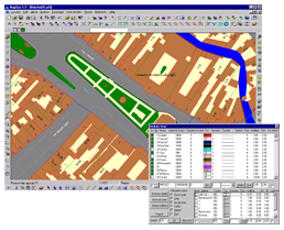
The MapSys Cadastral GIS offers specialized functionality for each stage of processing including the digital map creation, plotting cadastral and topographical plans, generating and combining geo-referenced data in order to obtain a validated relational geo-database. This can be used in MapSys or in other GIS programs or database application.
MapSys works with the following file extensions:
Note: You can click on any file extension link from the list below, to view its detailed information. The list of extensions used or otherwise associated with the application may not be complete, because many common file extensions on our website, such as jpg (pictures) or txt (text files), can be opened by a large number of applications, or are too general file format. However most, if not all directly associated file extensions should be listed with its appropriate program. Although its likely, that some file extensions may be missing from the list of associated file extensions with the application, yet they can be opened, be part of, or otherwise be associated with the program.
MapSys default file extension associations
Common file extensions used by MapSys
.dxf
Comparison table of actions that MapSys can perform with each of its associated file type beta
This table might not contain all possible associated or supported file types or may contain incorrect data.
If you need more information please contact the developers of MapSys (Geotop), or check out their product website.

