Home > Apps > Microsoft Windows
File extension list filtered by software name
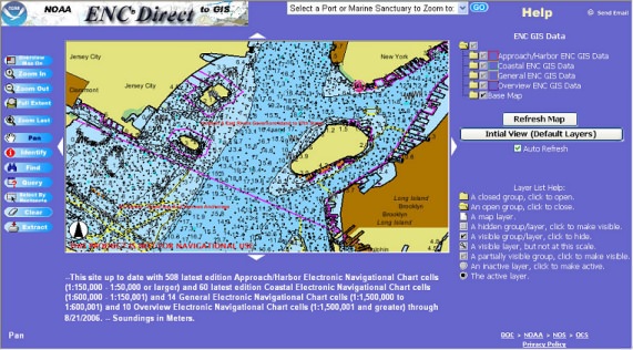
NOAA Electronic Navigational Charts to GIS
Found one file extension association related to NOAA Electronic Navigational Charts to GIS and 1 file format developed specifically for use with NOAA Electronic Navigational Charts to GIS.
Platform, operating system: ![]() Microsoft Windows
Microsoft Windows
Go to: NOAA Electronic Navigational Charts to GIS description
NOAA Electronic Navigational Charts to GIS website
Developer: United States Office of Coast Survey
NOAA Electronic Navigational Charts to GIS
Developer / company: United States Office of Coast Survey
NOAA Electronic Navigational Charts (NOAA ENC®s) have been developed to support safe navigation in U.S. waters and are available for free download. NOAA ENC®s are in International Hydrographic Organization (IHO) S-57 format, which is the data standard developed by the IHO to be used for the exchange of digital hydrographic data. NOAA ENCs can also be used for non-navigational purposes in Geographic Information Systems (GIS). In order for NOAA ENC®s to be used in GIS, the data must be translated from S-57 to a GIS-friendly format. The resulting data can be used for a variety of non-navigational purposes that involve geospatial analyses.
NOAA Electronic Navigational Charts to GIS works with the following file extensions:
Note: You can click on any file extension link from the list below, to view its detailed information. The list of extensions used or otherwise associated with the application may not be complete, because many common file extensions on our website, such as jpg (pictures) or txt (text files), can be opened by a large number of applications, or are too general file format. However most, if not all directly associated file extensions should be listed with its appropriate program. Although its likely, that some file extensions may be missing from the list of associated file extensions with the application, yet they can be opened, be part of, or otherwise be associated with the program.
NOAA Electronic Navigational Charts to GIS default file extension associations
![]() .enc
.enc
Comparison table of actions that NOAA Electronic Navigational Charts to GIS can perform with its associated file type beta
This table might not contain all possible associated or supported file types or may contain incorrect data.
If you need more information please contact the developers of NOAA Electronic Navigational Charts to GIS (United States Office of Coast Survey), or check out their product website.
File type \ Action | Open | Save | Edit | View | Play | Convert | Create | Record | Import | Export | Burn | Extract | Recover | Backup | Settings | Other | |
|---|---|---|---|---|---|---|---|---|---|---|---|---|---|---|---|---|---|
| Yes | Yes | Yes | - | - | - | Yes | - | - | - | - | - | - | - | - | - | Yes |

