Home > Trimble Navigation Limited
File extension list filtered by software name
GPS Pathfinder Office
Found 14 file extension associations related to GPS Pathfinder Office and 14 file formats developed specifically for use with GPS Pathfinder Office.
Platform, operating system: ![]() Microsoft Windows
Microsoft Windows
Go to: GPS Pathfinder Office description
Developer: Trimble Navigation Limited
Trimble software list & details
 GPS Pathfinder Office
Developer / company: Trimble
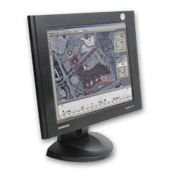
The Trimble GPS Pathfinder Office software adds value to your GIS data collection and data maintenance projects. It supports all aspects of GIS data collection and data maintenance for Trimble GPS Pathfinder receivers and GeoExplorer series handhelds.
The GPS Pathfinder Office software enables you to pre-plan your field sessions for more productive field work. The data dictionary editor creates custom pick-lists, automatic repeat feature, and numeric values so that collecting many features and attributes is easy and accurate. In the field, the data dictionary prompts the field crew to enter specific information-ensuring data integrity and compatibility with your GIS or database.
With GPS Pathfinder Office, files can be imported from a number of GIS and database formats so your GIS data can be taken back to the field for verification and update. You can review your data in map form to confirm it is exactly what you require before transferring it to your enterprise GIS.
The differential correction process can improve the accuracy of your GPS positions from around 10 meters to submeter and better, depending on the environment and your GPS receiver. With Trimble's new H-Star technology you can achieve accuracies of subfoot (30 cm) and even 8 inches (20 cm) with the GeoXH handheld and GPS Pathfinder ProXH receiver. And you can be sure your data is differentially corrected using the best quality base data available using Trimble's unique Integrity Index grading system.
To maximize productivity, GPS Pathfinder Office software offers a Batch Processing utility that automatically downloads the data, differentially corrects data to increase the accuracy, and exports it to a GIS database or mapping program—all in one step.
Key features:
- Differentially correct for improved GPS position accuracy including Trimble H-Star processing for subfoot accuracy with the GeoXH handheld and GPS Pathfinder ProXH receiver
- Unique Base Provider Integrity Index can automatically select and download the best quality base data available for differential correction
- Download and display raster imagery from Internet Map Servers (including ArcIMS and Open GIS formats, and MrSID, ECW and JPEG 2000 formats)
- Flexible map symbology so you can tailor your data display to your GIS
- Create and manage waypoint files
- Create sophisticated data dictionaries that mirror your GIS database
- Import data from Shapefile (SHP), MapInfo (MIF), AutoCAD (DXF), dBase (DBF), and Microsoft® Access (MDB) file formats for maintenance and verification of data in the field
- Review and edit GPS data before transferring it to a GIS
- Automate routine tasks such as data transfer, differential correction, and data export
- Supports Microsoft® Windows 2000, XP and Vista™ 32- and 64-bit operating systems
GPS Pathfinder Office works with the following file extensions:
Note: You can click on any file extension link from the list below, to view its detailed information. The list of extensions used or otherwise associated with the application may not be complete, because many common file extensions on our website, such as jpg (pictures) or txt (text files), can be opened by a large number of applications, or are too general file format. However most, if not all directly associated file extensions should be listed with its appropriate program. Although its likely, that some file extensions may be missing from the list of associated file extensions with the application, yet they can be opened, be part of, or otherwise be associated with the program.
GPS Pathfinder Office default file extension associations
Comparison table of actions that GPS Pathfinder Office can perform with each of its associated file type beta
This table might not contain all possible associated or supported file types or may contain incorrect data.
If you need more information please contact the developers of GPS Pathfinder Office (Trimble Navigation Limited), or check out their product website.
File type \ Action | Open | Save | Edit | View | Play | Convert | Create | Record | Import | Export | Burn | Extract | Recover | Backup | Settings | Other | |
|---|---|---|---|---|---|---|---|---|---|---|---|---|---|---|---|---|---|
| - | - | - | - | - | - | - | - | - | - | - | - | - | - | - | Yes | - | |
| Yes | - | - | - | - | - | Yes | - | - | - | - | - | - | - | - | - | Yes | |
| - | - | - | - | - | - | Yes | - | - | - | - | - | - | - | - | - | Yes | |
| Yes | - | - | - | - | - | - | - | - | - | - | - | - | - | - | - | Yes | |
| - | - | - | - | - | - | - | - | - | - | - | - | - | - | - | - | Yes | |
| - | - | - | - | - | - | Yes | - | - | - | - | - | - | - | - | - | Yes | |
| Yes | - | - | - | - | - | Yes | - | - | - | - | - | - | - | - | - | Yes | |
| - | - | - | - | - | - | - | - | - | - | - | - | - | - | - | - | Yes | |
| Yes | - | - | - | - | - | Yes | - | - | - | - | - | - | - | - | - | Yes | |
| - | - | - | - | - | - | Yes | - | - | - | - | - | - | - | - | - | Yes | |
| Yes | Yes | Yes | Yes | - | - | Yes | - | - | - | - | - | - | - | - | - | - | |
| - | - | - | - | - | - | - | - | - | - | - | - | - | - | - | - | Yes | |
| - | - | - | - | - | - | - | - | - | - | - | - | - | - | - | - | Yes | |
| - | - | - | - | - | - | - | - | Yes | - | - | - | - | - | - | - | - |

